About
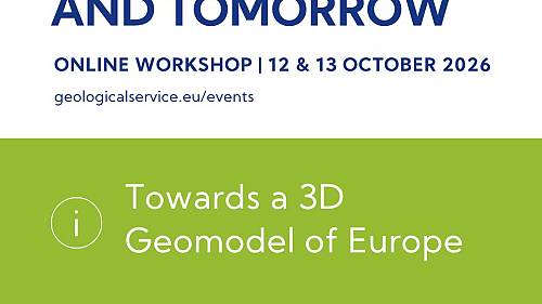
The estimation of resources and risk management at the European level require a harmonised understanding of the subsurface in 3 dimensions. A European 3D geomodel is a key point for harmonised quantification, essential not only for European policies and decision-makers but also for research and innovation. We will focus on national-scale initiatives and transboundary realisations before discussing the questions related to the European upscaling.
The workshop is organised by the Geomodelling team of the Geological Service for Europe project. It will combine presentations and discussions with more interactive moments to encourage everyone's participation.
Programme
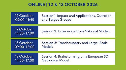
Session 1: Impact and Applications, Outreach and Target Groups
Monday, 12 October 2026 | 09:00 - 11:45 CEST
Link to join Session 1
- 09:00 - 09:20: Introduction to the workshop
Philippe Calcagno (BRGM) - 09:20 - 09:40: The value of a European 3D geological model: A EuroGeoSurveys perspective
Julie Hollis (EuroGeoSurveys) - 09:40 - 09:55: Interlude
Philippe Calcagno (BRGM) - 09:55 - 10:15: Geology is multidimensional, transcends political boundaries, and should be mapped accordingly
Michiel van der Meulen (TNO) - 10:15 - 10:35: Break
- 10:35 - 10:55: The economic value of a national geological 3D model – A cost/benefit analysis
Roland Baumberger (swisstopo) - 10:55 - 11:15: Towards subsurface geospatial planning in Europe
Rob van der Krogt (TNO), O.T. Sandström (SGU) - 11:15 - 11:45: Q&A, discussion
Session 2: Experiences from National Models
Monday, 12 October 2026 | 14:00 - 17:00 CEST
Link to join Session 2
- 14:00 - 14:05: Introduction
Sascha Görne (LfULG) - 14:05 - 14:25: Building a national 3D geological model of Switzerland: Integrating diverse geological settings and data constraints
Eva Kurmann, F.M. Piantelli, L. Reynolds, S. Signer, A. Ursprung, P. Wehrens, H. Müller (swisstopo) - 14:25 - 14:45: 25 Years of national 3D geological modelling in the UK: Key experiences, challenges and lessons learned
Ricky Terrington, T. Kearsey (BGS) - 14:45 - 15:00: Interlude
Philippe Calcagno (BRGM) - 15:00 - 15:20: Piece by piece: building the 3D geological model of Italy
Chiara D'Ambrogi, P. Petricca, M.P. Congi, F. Clemente, G. Castorina (ISPRA) - 15:20 - 15:40: Break
- 15:40 - 16:00: Scientific challenges for a multiscale, updatable national geological model
Simon Lopez (BRGM) - 16:00 - 16:20: 3D geological model of Poland V.2 – another lesson learned for national-scale models
Ewa Szynkaruk, Z. Małolepszy, D. Szrek & the Geomodelling Team (PGI-NRI) - 16:20 - 16:40: Building a cross-border geological model in a complex structural setting: The example of Einstein Telescope
Geert-Jan Vis (TNO), Y. Vanbrabant (GSB), H. Claes (KU Leuven), J. Deckers, B. Rombaut (VITO), M. Thüring (Lombardi SA) - 16:40 - 17:00: Q&A, discussion
Session 3: Transboundary and Large-Scale Models
Tuesday, 13 October 2026 | 09:00 - 11:50 CEST
Link to join Session 3
- 09:00 - 09:05: Introduction
Jan Franěk (CGS) - 09:05 - 09:25: 3D modelling in the Dutch subsurface: Data, dimensions & differences
Romée Kars, S. Nelskamp, J. Stafleu, J. ten Veen, R. Vernes (TNO) - 09:25 - 09:45: The European HIKE fault database: Challenges across borders and for 3D application
Esther Hintersberger (GeoSphere Austria) - 09:45 - 10:00: Interlude
Philippe Calcagno (BRGM) - 10:00 - 10:20: A retrospective and insights from more than 15 years of transboundary and large-scale modeling at the BGR
Stephan Steuer, F. Jähne-Klingberg, H. Thöle, F. Bense, H. Stück, M. Frey (BGR) - 10:20 - 10:40: Break
- 10:40 - 11:00: Discovering, sharing 3D models in a FAIR way
Sylvain Grellet (BRGM) - 11:00 - 11:20: Challenges to be addressed in continental-scale geological models
Tomasz Gogołek, Z. Małolepszy, O. Akkawi (PGI-NRI) - 11:20 - 11:50: Q&A, discussion
Session 4: Brainstorming on a European 3D Geological Model
Tuesday, 13 October 2026 | 14:00 - 17:00 CEST
Link to join Session 4
- 14:00 - 14:05: Introduction
Philippe Calcagno (BRGM) - 14:05 - 14:25: Usefulness of a 3D geomodel of Canada from a stakeholder perspective
Hazen Russell (NRCAN-RNCAN) - 14:25 - 15:55: World Café-style brainstorming (breakout sessions) on the following topics:
- Usefulness of a 3D EU geomodel for stakeholders, applications, European Commission, countries, …
Moderator: Julie Hollis (EuroGeoSurveys) - Technical questions, e.g. separated zones to be merged vs single EU zone, grids vs surfaces
Moderator: Chris Heerema (TNO) - Validation of the 3D geomodels : 1/ Technical validation, e.g. QC, unfolding 3D surface, 2/ Administrative stamp
Moderator: Nicolas Clausolles (BRGM) - Roadmap to reach a 3D EU geomodel
Moderator: Tim Kearsey (BGS)
- Usefulness of a 3D EU geomodel for stakeholders, applications, European Commission, countries, …
- 15:55 - 16:15: Break
- 16:15 - 16:55: Outcomes of the breakout discussions
Julie Hollis (EuroGeoSurveys), Chris Heerema (TNO), Nicolas Clausolles (BRGM), Tim Kearsey (BGS) - 16:55 - 17:00: Conclusion
Philippe Calcagno (BRGM)