Effective collaboration with stakeholders is crucial to maximise the impact of project results.
The stakeholder map was created to:
- Identify institutions, groups and (commercial and non-profit) organisations that are affected by the project or can potentially influence it
- Prioritise the relevance of stakeholders in terms of interest/influence ratio
- Provide input to the communication, dissemination and exploitation group to develop a stakeholder engagement plan
- Identify strategies and mechanisms to maximise support from and for stakeholders
Stakeholders were defined at regional, national, European and international level and categorised as follows: public institutions, commercial entities, professional users (academia and consultants) and ordinary citizens.
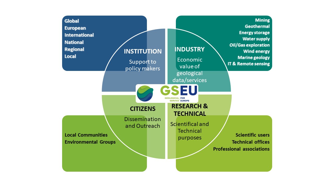
Figure 1: The identified main categories of stakeholders
In an initial survey, more than 400 stakeholders were identified. Of these, 13 were selected as our key stakeholders as they are most relevant to the project. The key stakeholders were interviewed to gather their thoughts on the expected outcomes of the project and to better understand their needs and expectations.
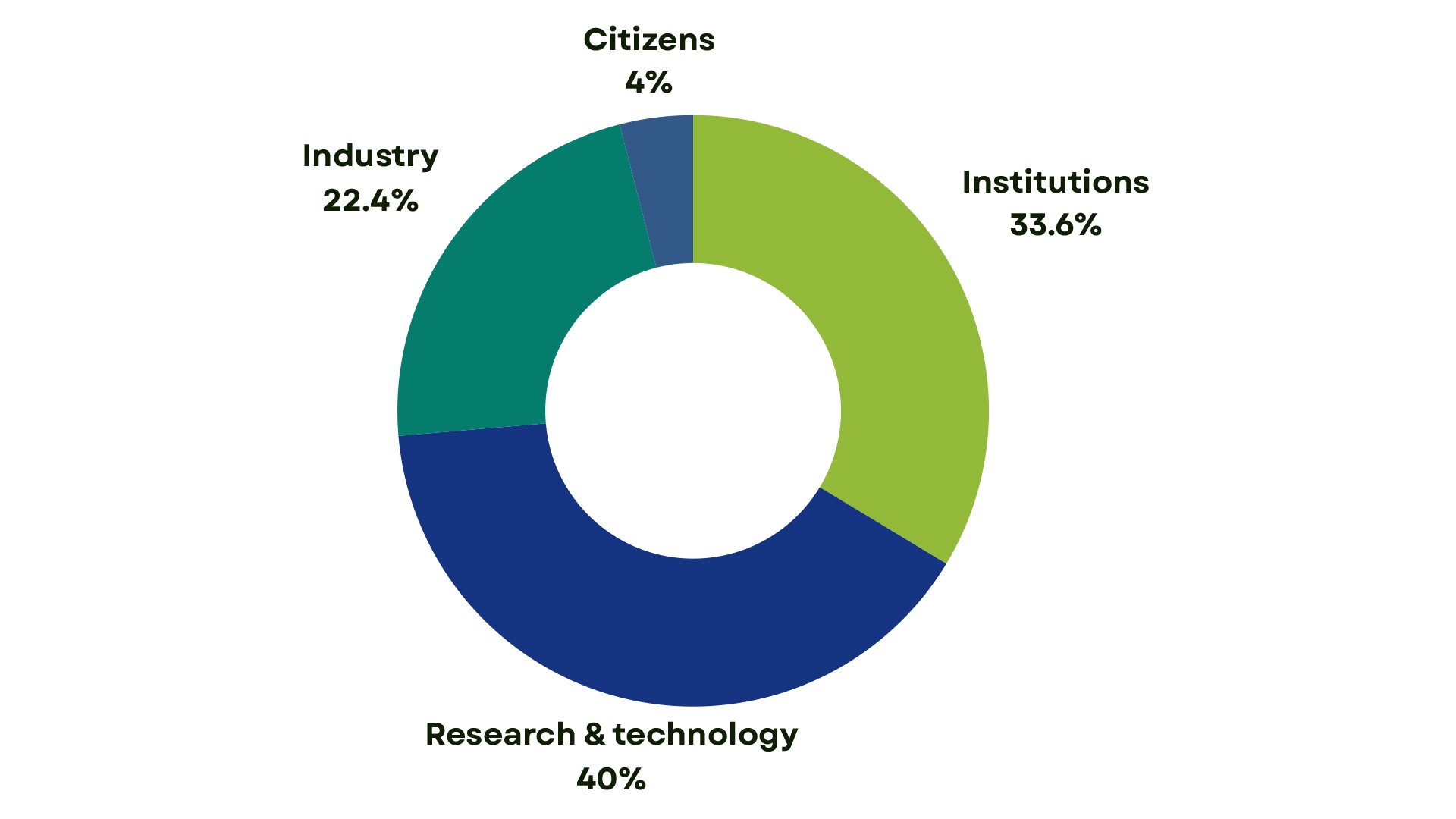
Figure 2: Distribution of the stakeholders identified for the GSEU project among the four main categories
The most represented stakeholder category is “Research & Technology” (40 %), which indicates that the products and results of the GSEU project are mainly intended for professional users. One third of the stakeholders belong to ‘’Institutions’’, which illustrates the already excellent connections of the National Geological Surveys and EuroGeoSurveys (EGS) to policy makers at national and EU level. Only a few of the identified stakeholders belong to the category "Citizens", most of which belong to environmental organisations. This highlights a gap in the interaction between geoscientists in public administrations and the general public that can be filled by appropriate awareness-raising activities on the importance of the subsurface for society in order to achieve the EU Green Deal goals.
At European level, the most important players are:
- European Commission Directorates-General (EC DG’s)
- Joint Research Centre (EC-JRC)
- European Environment Agency (EEA)
- European Plate Observing System (EPOS)
- European Marine Observation and Data Network (EMODnet)
- Raw Materials Information System (RMIS)
- European Federation of Geologists and
- other Associations representing different industrial sectors or professional groups
These important results have given us a better understanding of the stakeholders' needs and expectations and a clearer idea of the engagement strategy to be implemented in the next steps of the project.
Proposed Involvement Activities:
- General Stakeholder Events
- Thematic Workshops
- Webinars
- Training Sessions
- Side Events (at Scientific Conferences)
- Collection of Stakeholder Requirements
- Field Trips
Most stakeholder engagement activities will focus on building the capacity of stakeholders and users of data, services and products. These activities will take the form of face-to-face meetings (workshops) and online seminars (webinars) with people who are interested in the respective topics. To enable broader engagement, different types of events (tailored to different target groups) will be organised during the project to ensure a constant flow of communication in both directions.
Back